

AI Video Telematics vs GPS Tracking: What Does Each Solve?

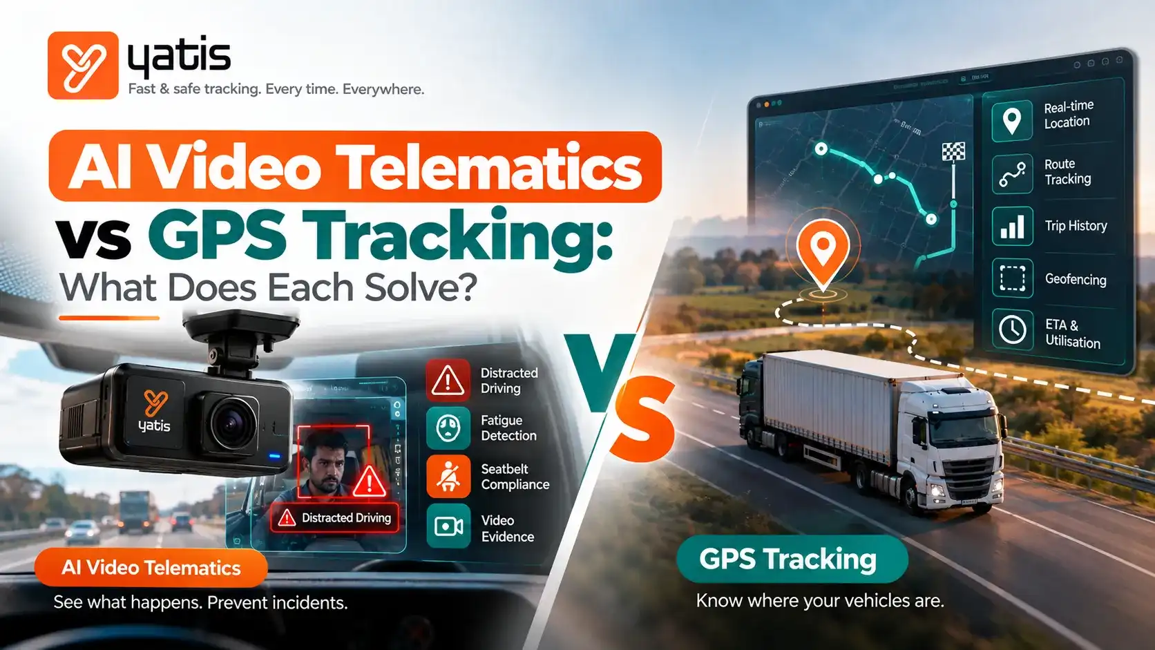
A practical comparison for fleet managers deciding whether location intelligence is enough — or whether video, AI event detection and visual evidence should be added to the fleet technology stack.
The Simplest Way to Think About the Two Technologies
GPS: Where?
Location, movement, routes and trip visibility.
AI Video: What Happened?
Visual context and AI-detected safety events.
Combined: Where + Context
Correlated location, vehicle and video intelligence.
GPS Scope: What Does GPS Tracking Actually Solve?
GPS tracking is fundamentally a location and movement visibility layer. A connected tracker determines or receives the vehicle's position and sends data to a fleet platform, where managers can monitor vehicles, replay routes, configure geofences and review supported operational events.
For example, the Yatis GPS platform provides real-time vehicle tracking, route history and trip playback, fuel-monitoring integrations, driver-behaviour insights, smart alerts and geofencing. Explore the Yatis GPS Tracking System.
Location
Know where a connected vehicle is and review historical positions.
Movement
Understand trips, stops, routes, ignition and supported speed data.
Operations
Use geofences, alerts, route history and fleet reporting to manage exceptions.
Depending on the device, vehicle interface and configuration, telematics can extend beyond basic GPS location to vehicle, fuel and driver-behaviour data. See what data a telematics device can collect.
Video Scope: What Does AI Video Telematics Add?
AI video telematics combines cameras with connected vehicle data, software and AI-based event detection. Instead of relying only on a location point or a numerical driving event, a fleet can have visual context around selected events.
Yatis AI Dash Cams provide live HD road and cabin video, real-time risk alerts, driver-behaviour coaching, GPS-backed incident detection and cloud uploads. Explore Yatis AI Dash Cams.
AI Events: What Can the Video Layer Detect?
The value of AI is not simply recording more video. It is reducing the amount of footage a fleet team has to manually review by identifying defined events or risk patterns.
| Event Category | GPS / Telematics Signal | AI Video Contribution |
|---|---|---|
| Speeding | Can provide recorded speed against configured thresholds. | Can add visual context around the road and traffic environment, where supported. |
| Harsh Braking | Can flag a sudden deceleration event. | Can help show what triggered the braking event, where the camera and AI support the scenario. |
| Lane-Related Risk | GPS alone does not generally show lane position. | Camera-based systems can detect supported lane-departure or related visual events. |
| Forward Collision Risk | GPS can provide vehicle position and movement context. | Camera / ADAS systems can detect supported forward-risk events; exact functionality varies by system. |
| Driver Distraction | GPS alone cannot see the driver's face or hands. | Cabin-facing AI can identify supported distraction events. |
| Phone Use | GPS alone does not visually establish phone use. | AI cabin monitoring may detect supported phone-use behaviour. |
| Seat-Belt Compliance | GPS alone does not visually establish belt use. | Camera AI may detect supported seat-belt events. |
NHTSA distinguishes technologies such as forward-collision warning and lane-departure warning from intervention technologies such as automatic emergency braking. Driver-assistance features remain assistive and do not make the vehicle autonomous. NHTSA: Driver Assistance Technologies.
Evidence: GPS Tells You Where; Video Can Add Context
Consider a harsh-braking event at 10:42 AM. GPS and video each contribute a different evidence layer to the same incident.
One Incident, Two Evidence Layers
| GPS / Telematics May Show | Video May Add |
|---|---|
| Vehicle location | Road and traffic scene visible to the camera |
| Speed or movement data, where supported | Vehicle ahead, pedestrian, obstruction or other visible context |
| Harsh-braking event timestamp | Visual sequence before and during the event |
| Route and trip history | Driver-facing context where a cabin camera is configured |
This is why video telematics should not be framed as “GPS replacement.” The two data layers answer different questions and become more useful when correlated.
Coaching: From Driver Score to Observable Behaviour
GPS-based driver behaviour systems can quantify events such as speeding, harsh braking, acceleration, cornering or idling, depending on the hardware and configuration. That is valuable for identifying patterns.
Video can make coaching more contextual. Instead of discussing only a score, a safety manager may be able to review the relevant event and discuss the behaviour using available evidence.
1. Detect
Identify a supported driving or visual safety event.
2. Contextualise
Connect the event with location, time, route and available video.
3. Coach
Discuss the specific behaviour rather than relying only on a generic score.
For fleet programmes, the objective should be consistent, documented coaching — not simply generating more alerts. Excessive alerts without prioritisation can create alert fatigue.
Insurance: What Role Can Telematics Play?
Telematics can provide useful evidence for risk management and claims workflows, but insurance outcomes are not automatic.
The U.S. National Association of Insurance Commissioners notes that telematics can measure factors such as mileage, time of day, GPS location, rapid acceleration, hard braking, hard cornering and airbag deployment, depending on the technology. It also notes that telematics can be used in insurance contexts for claims and usage-based insurance, while privacy and regulatory considerations remain important. NAIC: Telematics.
Cost: What Are You Actually Paying For?
The comparison should not be reduced to “GPS is cheaper and AI video is expensive.” A better purchasing model is to compare the operational problem, required data and total cost of ownership.
| Cost Component | GPS Tracking | AI Video Telematics |
|---|---|---|
| Hardware | GPS / telematics tracker and installation. | Camera hardware, storage components and installation. |
| Connectivity | Mobile data for telemetry transmission. | Mobile data requirements can increase when video is streamed or uploaded. |
| Cloud / Software | Fleet dashboard, alerts, reporting and data storage. | Video platform, event processing, AI features and video storage. |
| Operations | Fleet monitoring and exception management. | Video review, event triage, coaching and evidence governance. |
| Value to Measure | Visibility, route control, utilisation, fuel, idling and driver-event management. | Safety context, incident evidence, driver coaching and risk-event management. |
Then compare those costs with the operational outcomes the solution is intended to improve. Avoid using a generic industry ROI percentage without validating it against your own fleet baseline.
GPS vs AI Video Telematics: Comparison Matrix
| Capability | GPS Tracking | AI Video Telematics | Combined Architecture |
|---|---|---|---|
| Real-time location | Core capability | Usually relies on integrated GPS / telematics | Yes |
| Route history | Core capability | Available when GPS is integrated | Yes |
| Geofencing | Core fleet feature | Available through platform integration | Yes |
| Driver behaviour | Supported events such as speeding / braking depending on hardware | Can add visual context to supported events | Strongest context |
| Road-facing video | No, by itself | Yes | Yes |
| Cabin video | No, by itself | Available on dual-facing configurations | Yes |
| Visual AI events | No, by itself | Supported events depend on AI / camera configuration | Yes |
| Incident evidence | Location and telematics records | Video + event context + telematics | Richer evidence set |
| Driver coaching | Event / score-based coaching | Event + visual-context coaching | Combined |
| Operational tracking | Strong | Not the primary purpose by itself | Strong |
| Video storage needs | Low relative to video systems | Higher; depends on recording / upload policy | Higher |
Combined Architecture: How GPS and AI Video Work Together
The strongest architecture is often a connected evidence chain rather than two isolated systems.
Fleet Safety Data Architecture
Vehicle
GPS + sensors capture position and vehicle signals.
Camera
Road + cabin video provides visual context.
AI / Rules
Event detection identifies relevant risk events.
Cloud
Evidence + history stored for review and reporting.
Fleet Team
Alert + coach + act on prioritised events.
The operational loop becomes:
- Capture: GPS, vehicle signals and camera data are collected.
- Detect: configured rules or AI identify relevant events.
- Correlate: event time and vehicle identity connect video with telematics context.
- Prioritise: high-value events are surfaced to the fleet team.
- Review: the manager examines the available evidence.
- Coach or escalate: the appropriate response is initiated.
- Measure: recurring patterns are tracked over time.
Yatis describes its GPS platform as combining tracking, alerts, fuel monitoring, driver behaviour insights and video telematics within a central fleet platform. See Yatis GPS Tracking.
When Is GPS Tracking Enough?
GPS tracking may be sufficient when your primary operational problems are location visibility, route monitoring, geofencing, utilisation, trip history, idling, fuel monitoring or basic driver-event management.
- You mainly need to know where vehicles are.
- You need route history and trip playback.
- You need geofence or route-deviation alerts.
- You need fleet utilisation and movement reporting.
- You need supported speeding, idling or harsh-event monitoring.
- You do not have a business requirement for visual incident evidence.
When Should You Add AI Video Telematics?
Video becomes more relevant when your risk-management problem depends on information that location data cannot directly show.
- Frequent disputes around road incidents.
- Need for visual context around high-risk driving events.
- Distracted-driving or phone-use monitoring requirements.
- Need for road and cabin evidence around incidents.
- Driver coaching programmes that benefit from event footage.
- High-value vehicles, cargo or routes where incident evidence has significant operational value.
How to Evaluate Vendors: Ask These 12 Questions
AI Video Telematics Buying Checklist
- Which AI events are actually supported today?
- Which events are processed on-device versus in the cloud?
- What happens when network connectivity is unavailable?
- How is video associated with GPS event timestamps?
- How long is routine video retained?
- How are critical-event clips preserved?
- Can managers search events without reviewing hours of footage?
- How are false positives handled?
- Can event severity or thresholds be configured?
- What driver-coaching workflow is available?
- What are the hardware, connectivity, storage and platform costs?
- What privacy, access-control and evidence-sharing controls are available?
Common Mistakes When Comparing GPS and Video Telematics
1. Treating Them as Mutually Exclusive
GPS and video answer different questions. A comparison should start with the operational problem, not simply the device price.
2. Assuming Every “AI Camera” Has the Same Event Library
AI detection varies by hardware, software, camera position, model and configuration. Ask vendors for the exact event list and technical limitations.
3. Buying Video Without an Evidence Workflow
More footage is not automatically more value. Define event triggers, retention, review ownership, escalation and coaching processes.
4. Promising Insurance Savings Before Confirming the Programme
Telematics can support risk and claims processes, but insurance pricing is insurer- and policy-specific.
5. Measuring Alerts Instead of Outcomes
The goal is not maximum alert volume. Track meaningful measures such as high-risk events per 1,000 km, repeat events, coaching completion and changes in event frequency.
Recommended KPI Framework for a Combined GPS + Video Programme
| KPI | Why Track It? |
|---|---|
| High-risk events / 1,000 km | Normalises safety events across vehicles with different mileage. |
| Repeat high-risk events | Identifies persistent behaviour requiring intervention. |
| Video-confirmed events | Shows how often selected telematics events have useful visual context. |
| Coaching completion rate | Measures whether identified risk leads to an operational action. |
| Post-coaching event rate | Tracks whether behaviour changes after coaching. |
| Incident investigation time | Measures whether connected evidence speeds up review. |
| Evidence retrieval time | Tracks how quickly relevant footage / data can be located. |
| False-positive review rate | Helps evaluate alert quality and workload. |
Conclusion: Think in Layers, Not “Either GPS or Video”
GPS tracking and AI video telematics solve different layers of fleet visibility. GPS provides the location, movement and operational context that fleets need every day. AI video telematics can add visual evidence and AI-detected safety context around selected events.
If your primary requirement is fleet visibility and operational control, start by defining the GPS and telematics data you actually need. If your risk profile requires visual context, driver-facing safety monitoring or stronger incident evidence, evaluate the additional value of AI video.
For many fleets, the practical architecture is not GPS versus AI video. It is GPS + video + AI + workflow — with each layer assigned a clear operational purpose.
Explore Yatis fleet solutions and related guides in resources to connect location data with visual safety intelligence.
External Sources & Further Reading
External sources are included for technology, safety and insurance context. Product capabilities vary by hardware, software, configuration and jurisdiction.
Frequently Asked Questions About AI Video Telematics vs GPS Tracking
Combine GPS Visibility With Video Intelligence
See how Yatis connects GPS tracking, AI dash cams and fleet workflows — from location visibility and route control to video evidence, safety events and driver coaching.
Get Started Today →